


Summary
On April 3, 1864, Steele's advance troops crossed the Little Missouri River at Elkins' Ferry.
On April 4, 1864, Maj. Gen. John Sappington Marmaduke attacked the Union forces at Elkins' Ferry but failed to drive them back across the Little Missouri and fell back to Prairie D'Ane. On April 5-9, 1864, Steele's army rested on the high ground above the Little Missouri to await the arrival of Thayer's Frontier Division before they marched forward onto Prairie D'Ane.
The Route
▷ We previously began at Okolona / Battle of the Bees, ending at the junction of Arkansas 51 and US 67 about 2.2 miles from I-30, which is our starting point.
▷ Arkansas 51 at US 67, Clark Co ARTake the right (westward) on US 67 toward Prescott. Travel 2.3 miles.
▷ Little Missouri River Clark/Nevada Co LineCross the Little Missouri River and continue 5.5 miles to Nevada 37.
▷ US 67 at Nevada 37, Nevada Co ARTurn right (northward) on Nevada 37 and travel 4.4 miles, including crossing over I-30 and just past a curve to the right, to the church on the right (southeast from the road).
▷ Missionary Grove Baptist Church, Nevada 37, Nevada County ARThis is the location of a marker. Continue on Nevada 37 on gravel an additional 4.0 miles.
▷ Elkin's Ferry, Arkansas Game and Fish Boat Ramp, Nevada 37, Nevada County ARCAUTION: Road may be flooded and may end in water. Continue northward on Nevada 37, a gravel road, for an additional 4.0 miles to the Arkansas Game and Fish boat ramp at the Elkins' Ferry Battlefield. Return 12.4 miles to U.S. 67.
▷ Nevada 37 at US 67, Nevada County ARTurn right (southwestward) onto US 67 for 1.7 miles into downtown Prescott.
▷ US 67/West 1st Street N at US 371/North Main St, Prescott ARAt the junction of US 67 and US 371 is a mural. Turn right (northward) onto US 371/North Main Street.
▷ This brings us to the next point of interest, Prairie D'Ane / Battle of Gum Grove.
Google Maps
Show my location on map
At the popup, you must allow your web brower (not us) to know your location.
Your location should update every 5 seconds.
This brings us to the next point of interest, Prairie D'Ane / Battle of Gum Grove.
The Roads
The Camden Expedition Scenic Highway moves south through western Clark County to US Highway 67. At the time of the Civil War and later, travelers going from southwest Arkansas to Arkadelphia forded the Little Missouri River or took a ferry and travelled through the hills of Clark County to Arkadelphia. The lands along the Little Missouri River in southwestern Clark County were low and wet---too difficult for travel. The coming of the railroad in the 1870s and the development of new towns such as Gurdon and Prescott began to change the pattern of travel. The first non-railroad bridge in the region was built over the Little Missouri a short distance north of what is now the Okolona exit on Interstate 30 in 1908. The Bankhead Highway came in the area circa World War I and enabled travel by cars and trucks to the developing railroad towns and sawmill towns. A few years later in the late 1920s and early 1930s, US Highway 67 further improved automotive travel in Arkansas.
Little Missouri River Bridge
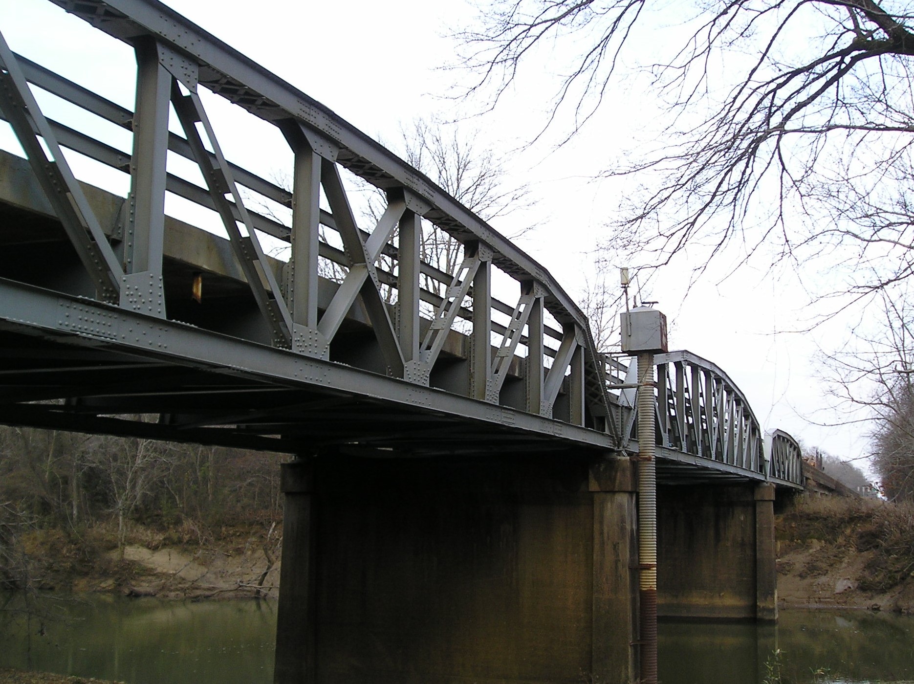
As the Byway crosses the Little Missouri River from Clark into present-day Nevada County, a memento of the coming of Highway 67 still stands and spans the river. It is the Highway 67 bridge, a Parker pony truss bridge. With three Parker pony trusses and a length of 1,161 feet, it is one of only seven such multi-span bridges remaining in Arkansas. It was built by the Vincennes Bridge Company of Vincennes, Indiana, in 1931. It is still in use and is in good repair. It was nominated to the National Register of Historic Places in 2007. On the west bank of the Little Missouri on the south side of the bridge and partially under the bridge is an Arkansas Game and Fish boat slip and parking area. The site encourages boating, fishing, hunting and wildlife observation on and along the river.
Photo by Peggy Lloyd
Nevada County
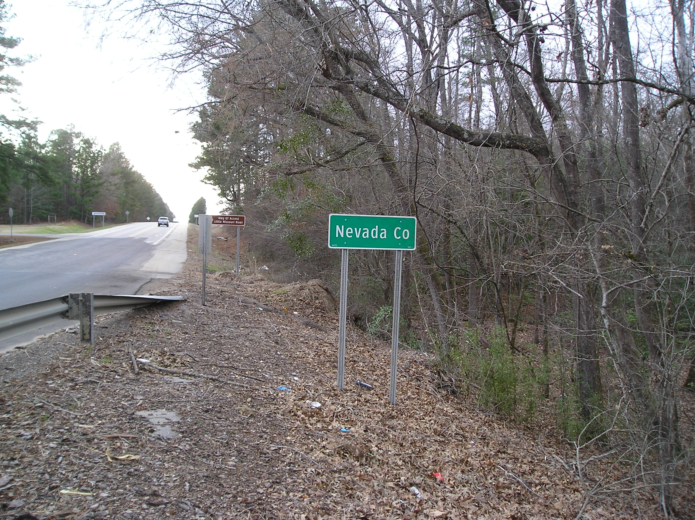
Nevada County did not exist at the time of the Civil War. It was formed in 1871 from parts of Hempstead, Ouachita and Columbia Counties. The Civil War sites at Elkins' Ferry, Prairie D'Ane and the village of Moscow were in Hempstead County in 1864. The county seat was at Washington, Arkansas, then also the Confederate capital of Arkansas after the Union Army took Little Rock in September 1863.
Photo by Peggy Lloyd
Missionary Grove Baptist Church
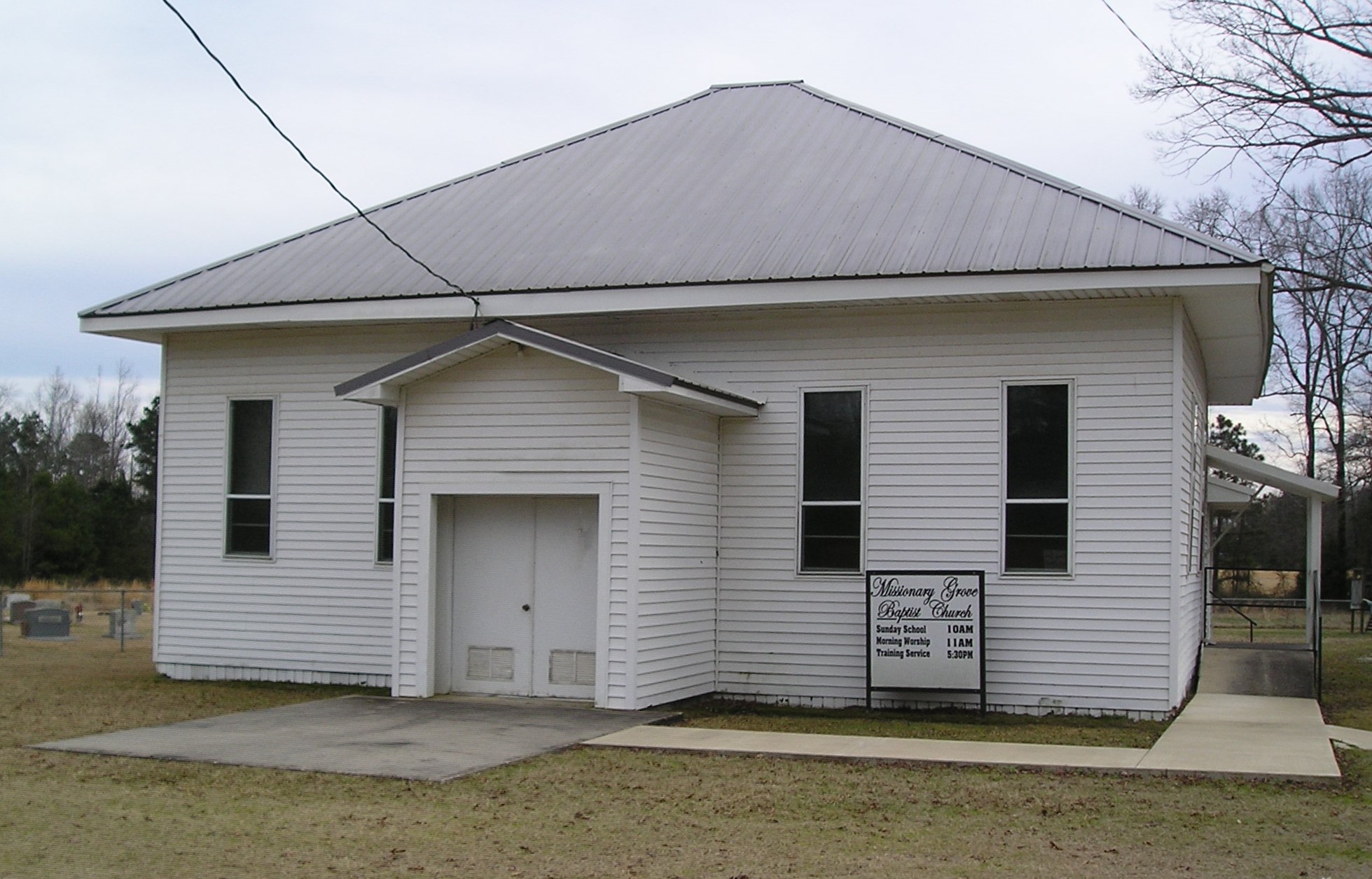
The Missionary Grove Baptist Church, also known as the Nubbin Hill Church, was founded in 1885 by a member of the Wingfield family. The cemetery is a resting place for generations who have lived in the vicinity.
Photo by Peggy Lloyd
Signage at Nubbin Hill
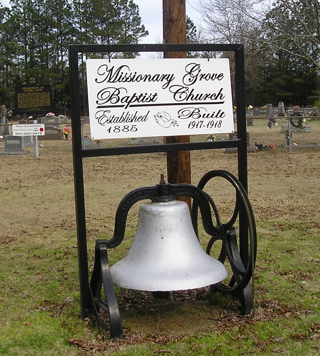
Signage at Missionary Grove Baptist Church.
Photo by Peggy Lloyd
Engagement at Elkins' Ferry Marker
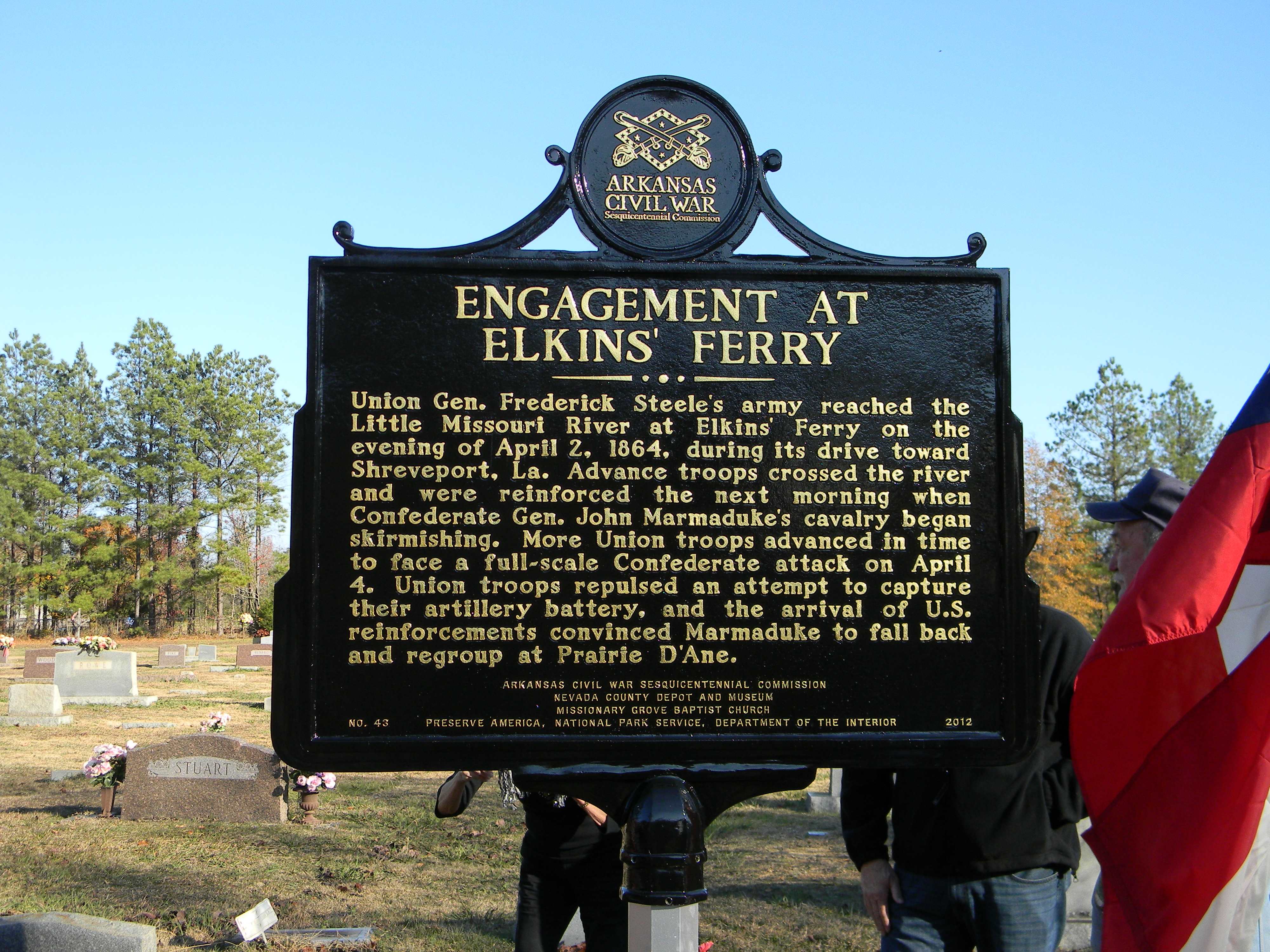
The Union army forded the river about a quarter of a mile south of the Game and Fish boat ramp. An old road east of existing County Road 37 led from the bottomlands to the ridge line near the Cornelius Farm at the time of the Civil War. A two-sided Civil War Sesquicentennial marker is just inside the cemetery at the Missionary Grove Baptist Church. The front side describes the action at Elkins' Ferry.
Union Gen. Frederick Steele's army reached the Little Missouri River at Elkins' Ferry on the evening of April 2, 1864, during its drive toward Shreveport, La. Advance troops crossed the river and were reinforced the next morning when Confederate Gen. John Marmaduke's cavalry began skirmishing. More Union troops advanced in time to face a full-scale Confederate attack on April 4. Union troops repulsed an attempt to capture their artillery battery, and the arrival of U.S. reinforcements convinced Marmaduke to fall back and regroup at Prairie D'Ane.
Photo by Judy Duke
The Cornelius Farm Marker
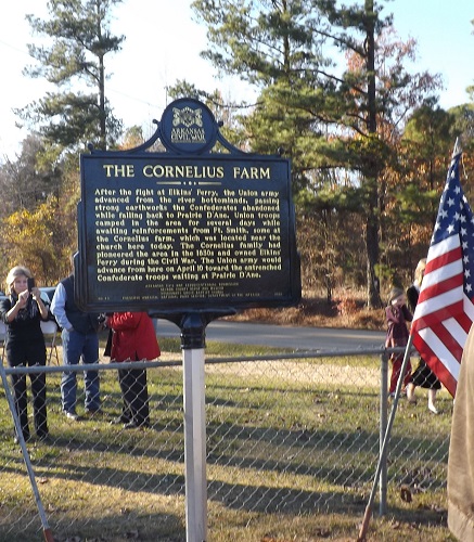
The back side of the marker commemorates the Cornelius family whose farm was located nearby and who had been associated with the ferry for many years. Malinda Ward Cornelius, the matriarch of the Cornelius family at the time of the Camden Expedition, and other family members are buried here. Her husband Jester Cornelius had died in the Civil War while serving in the Confederate Army.
After the fight at Elkins' Ferry, the Union army advanced from the river bottomlands, passing strong earthworks the Confederates abandoned while falling back to Prairie D'Ane. Union troops camped in the area for several days while awaiting reinforcements from Ft. Smith, some at the Cornelius farm, which was located near the church here today. The Cornelius family had pioneered the area in the 1830s and owned Elkins' Ferry during the Civil War. The Union army would advance from here on April 10 toward the entrenched Confederate troops waiting at Prairie D'Ane.
Photo by Judy Duke
Elkins' Ferry Battlefield as a National Historic Landmark
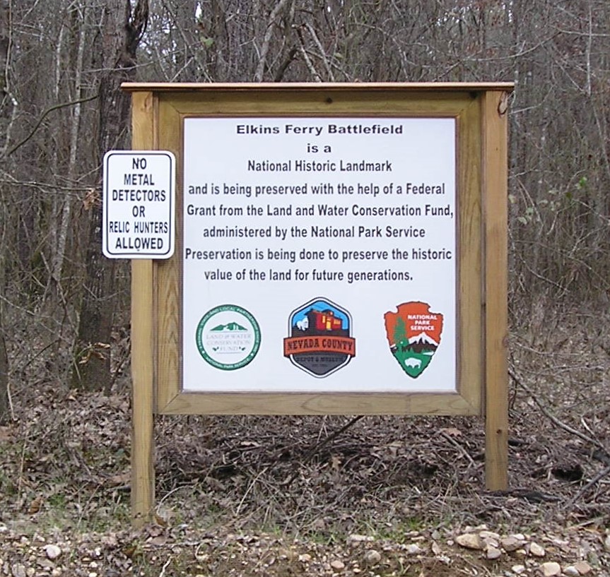
Elkins' Ferry Battlefield is a National Historic Landmark and is being preserved with the help of a Federal Grant from the Land and Water Conservation Fund, administered by the National Park Service. Preservation is being done to preserve the historic value for the land for future generations.
The Confederate forces had also built fortifications along the ridge line where the land drops down to the flats leading to the Little Missouri. A 448-acre tract of land, now owned by the Nevada County Depot & Museum, is one of the few remaining pristine battlefield sites. Nevada County Road 37 ends at the Game and Fish boat slip on the Little Missouri River. The Union Army crossed the river at a ford about a quarter of a mile south of the boat slip and followed the road through the bottoms to higher ground near the Cornelius Farm. They rested near the farm for a few days until Steele could reach Thayer's troops who had taken the wrong road and ended up at Rockport. Thayer and his force finally arrived on April 9. The next day on April 10, Steele proceeded to Prairie D'Ane. Earlier, the Confederate forces had decided to pull back to defend the road to Washington at Prairie D'Ane, and no fighting had taken place near the present-day church and cemetery.
Photo by Peggy Lloyd
Prescott Mural

The mural at the junction of Highways 371-24-67 is an image of the history of Prescott. Prescott did not exist at the time of the Civil War. It is a railroad town that was laid out in August 1873 by the Cairo and Fulton Railroad and incorporated a year later. For these reasons, the train locomotive is at the center of the mural. The city is named for William Hickling Prescott, a New Englander and historian who was much admired by the owners of the railroad. The little girl points to the Iron Bridge built over the Little Missouri in 1908 by Clark and Nevada Counties. It superseded the fords and ferries of the past. The timber and cattle represent important products of the county today.
Photo by Peggy Lloyd
Up Next
This brings us to the next point of interest, Prairie D'Ane / Battle of Gum Grove.