


Summary
April 10-12, 1864. The Union and Confederate armies skirmished at Prairie D'Ane before Maj. Gen. Sterling Price surmised that Steele's goal was to capture the Confederate state capital at Washington. The Confederate Army abandoned fortifications on the prairie and fell back toward Washington. Steele, fearing that the Union army in Louisiana was defeated and in retreat, and, with his own men almost out of food, abandoned the drive south, turning instead toward Camden in the hope of finding supplies.
The Route
▷ We previously began at Elkins' Ferry, ending at the junction of US 67 and US 371 at a mural in downtown Prescott, which is our starting point.
▷ US 67 at US 371/N Main Street, Prescott ARTravel on US 371/ North Main Street northward for 0.4 miles, rounding a curve to the right.
▷ US 371/N Main Street at Arkansas 19, Prescott ARContinue straight onto Arkansas 19 and continue 2.1 miles, crossing Interstate 30. On the west side is the site of the Prairie D'Ane battle, and the point at which the Union Army first entered the battlefield. This point can be reached on I-30 exit 46. Return along US 371 for 2.1 miles.
▷ Prairie D'Ane Battlefield, Prescott ARThe battlefield extends to the west, north of the interstate. However, there have been no roads that lead from the east side to the west side. Therefore, return along Arkansas 19 to the US 371 junction.
▷ Arkansas 19 at US 371, Prescott ARTurn right (westward) onto US 371/Greenlawn Street and travel about 2.5 miles, crossing Interstate 30. There's a marker at the truck stop. This point can be reached on I-30 exit 44.
▷ US 371 at Nevada 30, Prescott ARTurn right (north) onto Nevada 30, the western boundary of the truck stop. Just past the pavement and along the gravel portion of this road is a panoramic view of the prairie.
▷ End of Battlefield, Nevada County ArAfter a mile, certainly by 1.5 miles, you are past the battlefield, so turnaround and go back the 1.5 miles to U.S. 371.
▷ Nevada 30 at US 371, Prescott ARTurn left (eastward) onto US 371 and drive back toward US 67. It's 2.5 miles to the stop sign at US 371 and Arkansas 19.
▷ U.S. 371/Greenlawn at Ark 19/N Main St, Prescott ARTurn right (southeastward) to stay on U.S. 371, making the left curve and traveling 0.4 miles to the mural corner at U.S. 371/N Main St and U.S. 67/W 1st St.
▷ Mural corner of U.S. 371/N Main St and U.S. 67/W 1st S, Prescott ARArrive at the mural intersection.
▷ Arkansas 24/N Main Street at US 67/West 1st Street, Prescott ARTurn left (southwestward) onto US 67 S and travel 3.5 blocks to the Nevada County Depot and Museum.
▷ Nevada County Depot and Museum, US 67/West First Street South, Prescott ARArrive Nevada County Depot and Museum.
▷ This brings us to the next point of interest, Washington.
Google Maps
Show my location on map
At the popup, you must allow your web brower (not us) to know your location.
Your location should update every 5 seconds.
This brings us to the next point of interest, Washington.
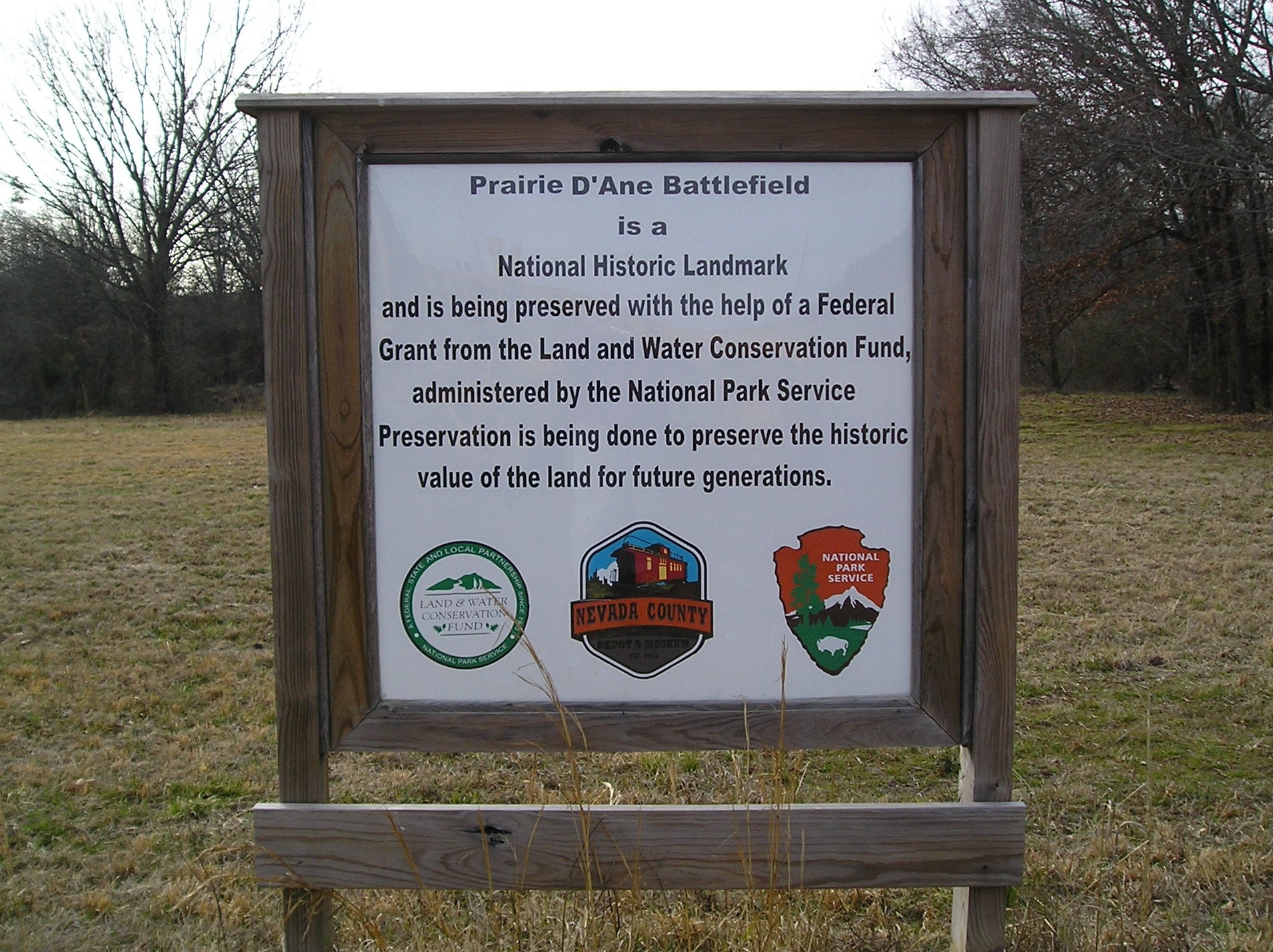
Prairie D'Ane Battlefield as a National Historic Landmark
I-30 exit 46, northwest side is the location where the Union Army entered the Prairie D'Ane battlefield.
Prairie D'Ane Battlefield is a National Historic Landmark and is being preserved with the help of a Federal Grant from the Land and Water Conservation Fund, administered by the National Park Service. Preservation is being done to preserve the historic value for the land for future generations.
Photo by Peggy Lloyd
Skirmishes at Prairie D'Ane
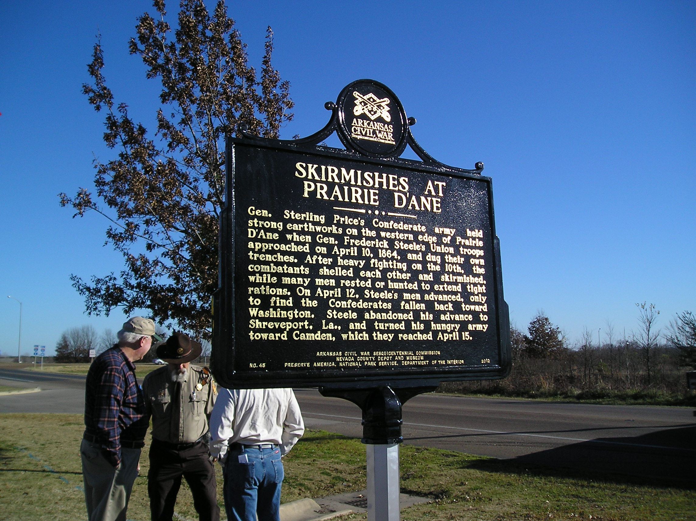
I-30 exit 44, north side is the location of the marker.
Gen. Sterling Price's Confederate army held strong earthworks on the western edge of Prairie D'Ane when Gen. Frederick Steele's Union troops approached on April 10, 1864, and dug their own trenches. After heavy fighting on the 10th, the combatants shelled each other and skirmished, while many men rested or hunted to extend light rations. On April 12, Steele's men advanced, only to find the Confederates fallen back toward Washington. Steele abandoned his advance to Shreveport, La., and turned his hungry army toward Camden, which they reached April 15.
Photo by Peggy Lloyd
The Prairie D'Ane Battlefield

Prairie D'Ane is an irregularly-shaped open grassland six to seven miles long and two to three miles wide. It had fewer trees at the time of the Civil War. Confederate cannons were positioned on high ground to north. In the winter months when the grass is not so high, Civil War trenches are still visible just to the north of County Road 30
Re-enactments
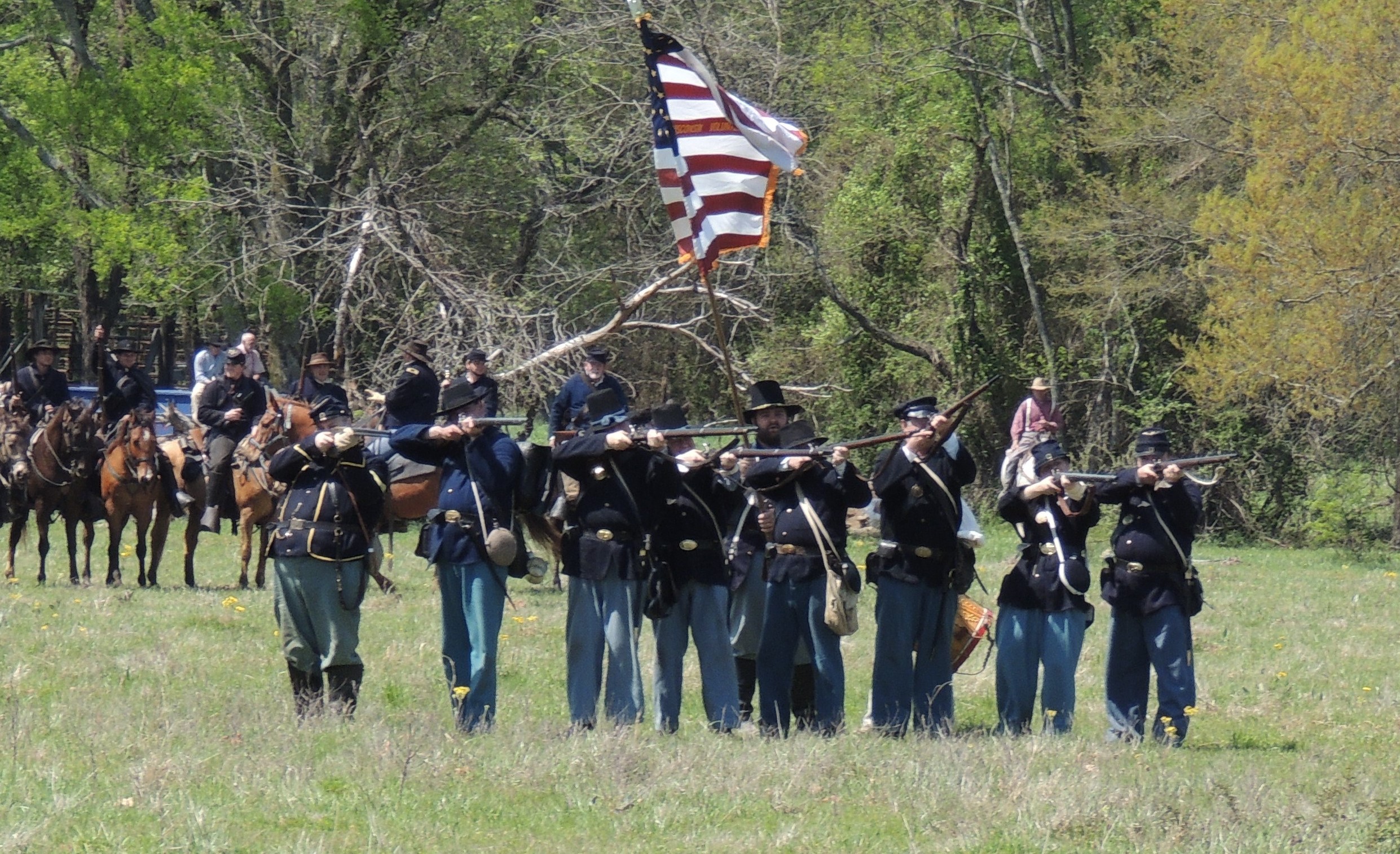
Since 2014 re-enactments have taken place at intervals on Prairie D'Ane. This trend will only continue in the future as the area develops for tourism. The Nevada County Depot and Museum owns 808 acres of the battlefield. The entire prairie is about 5,000 acres, and the armies moved over the entire area. Prairie D'Ane was designated as a National Historic Landmark in 1994.
Photo by Paul Oller of Hope, AR
Re-enactments
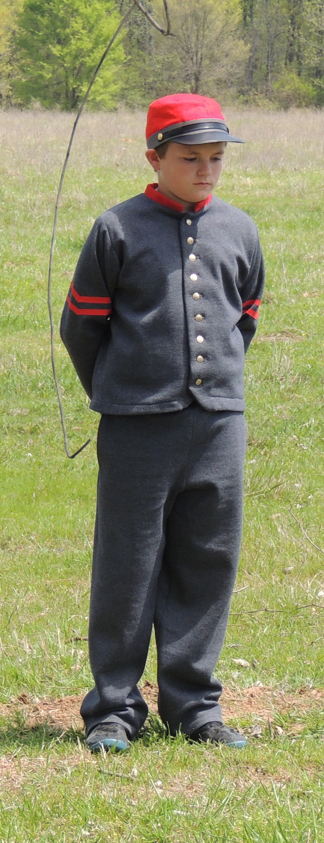
Boy re-enactor at the 2014 re-enactment on Prairie D'Ane
Photo by Paul Oller of Hope, AR
Nevada County Depot and Museum
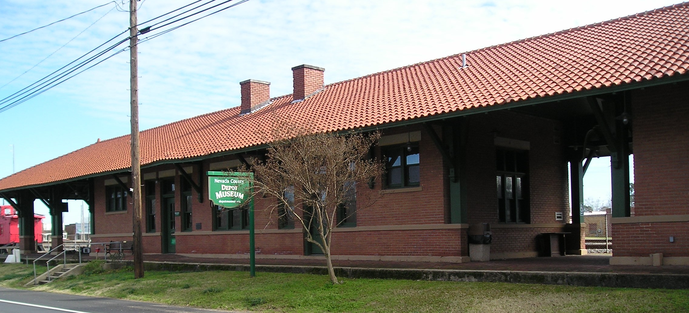
The Cairo and Fulton built the railroad and established Prescott in 1873. In early 1874, the Cairo and Fulton became the St. Louis, Iron Mountain and Southern Railroad. Later the Iron Mountain merged with the Missouri Pacific for a time, and then it became only the Missouri Pacific. Today the railroad passing through Prescott is the Union Pacific. The depot that houses the Depot Museum was built in 1912. It was an active stop for passengers and freight until 1969. Ultimately, it became a local history museum and acts as a visitor center for the Civil War sites in the county. It has collections of photos, railroad memorabilia, Civil War relics found locally and an enlarged portion of a map of the region at the time of the 1864 Camden Expedition. The map was done by Confederate engineers working out of Shreveport and fell into the hands of the Union Army Topographical Engineers near the end of the war. The Depot Museum is open from Tuesday to Friday from 10 to 3 and by appointment. See the website www.DepotMuseum.org for further details and contact information.
Photo by Peggy Lloyd
Caboose at Nevada County Depot and Museum
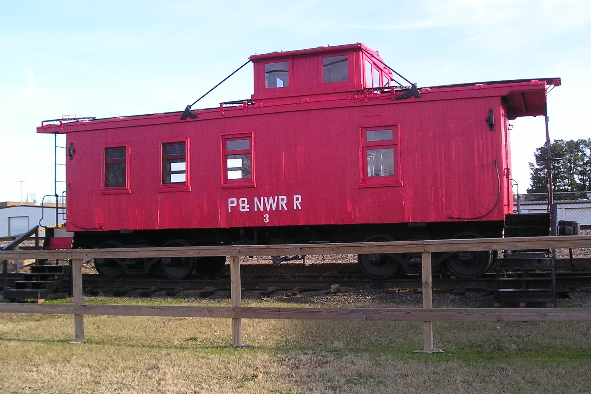
The caboose was purchased by the Prescott and Northwestern Railroad (the P&NW) from the Cotton Belt Railroad in 1920. The Prescott and Northwestern was owned by the Ozan Lumber Company and was one of the short line railroads in Arkansas. It transported passengers from the vicinity to and from Prescott, hauled timber to and from the sawmills and brought peaches, cantaloupes and other produce crops to the mainline railroad for sale in the region and out-of-state.
Photo by Peggy Lloyd
Up Next
This brings us to the next point of interest, Washington.