


Map of the route taken during the Camden Expedition by the army of General Frederick Steele from Little Rock (Pulaski County) to Camden (Ouachita County) from March 24 through May 2, 1864.
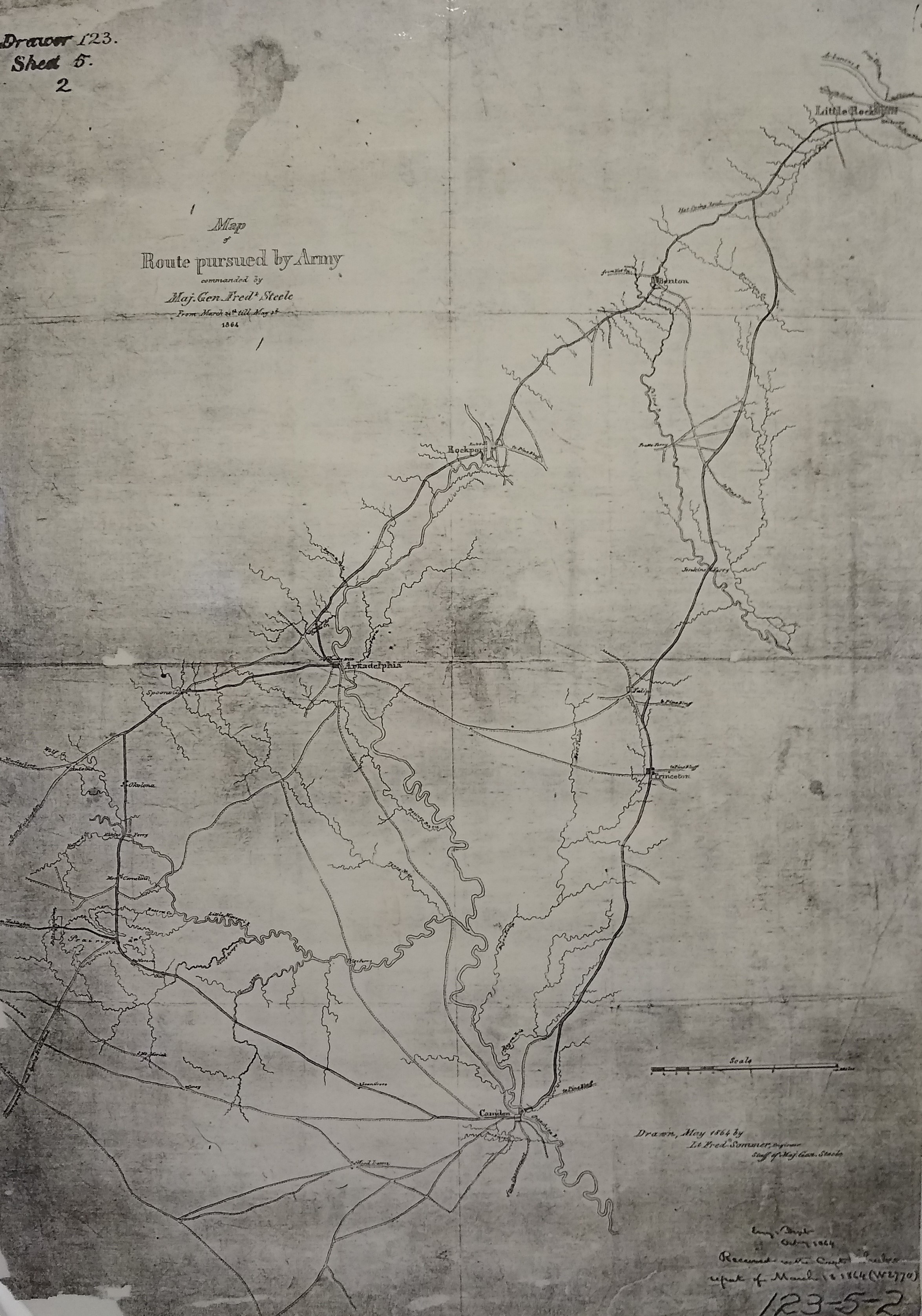
Map drawn by Lieutenant Fredrick Sommer of General Steele's engineer staff. Courtesy of the National Archives and Records Administration
Map drawn by Lieutenant Fredrick Sommer of General Steele's engineer staff. Courtesy of the National Archives and Records Administration